

A catastrophic and deadly storm surge is occurring along portions of the Florida Big Bend coast, where inundation could reach as high as 20 feet above ground level, along with destructive waves. There is also a danger of life-threatening storm surge along the remainder of the west coast of the Florida Peninsula.
Catastrophic hurricane-force winds are occurring near the coast within the eyewall of Helene and will spread inland over portions of northern Florida and southern Georgia.
Damaging wind gusts will penetrate well inland over portions of Georgia and the Carolinas tonight, particularly over the higher terrain of the southern Appalachians. Residents in these areas should be prepared for the possibility of long-duration power outages. If you use a generator after the storm, be sure it is placed outside at least 20 feet away from doors, windows, and garages to avoid deadly carbon monoxide poisoning.
Catastrophic and life-threatening flash and urban flooding, including numerous significant landslides, is expected across portions of the southern Appalachians through Friday. Considerable to locally catastrophic flash and urban flooding is likely for northwestern and northern Florida and the Southeast through Friday. Widespread significant river flooding and isolated major river flooding are likely.
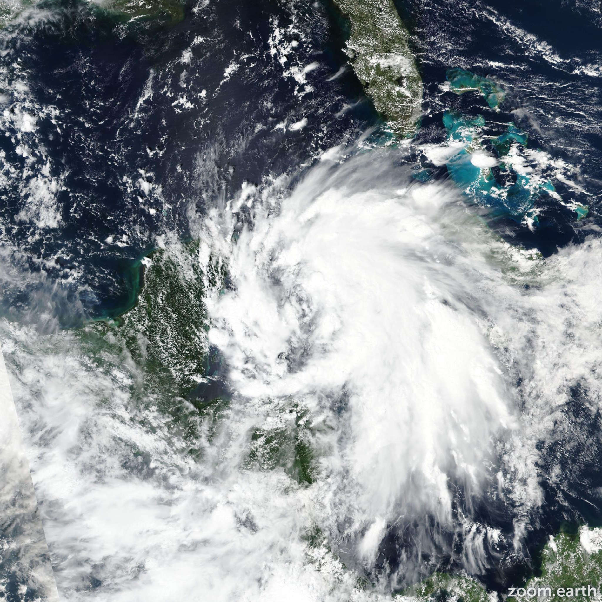
The hurricane is about to make landfall in the Florida Big Bend region. Timely observations from Air Force and NOAA Hurricane Hunter aircraft showed that Helene continued to strengthen rapidly to Category 4 status before it approached the coast, with the central pressure falling at about 3 mb per hour since this afternoon (26 September). Peak 700 mb flight-level winds from the aircraft were 155 mph (136 knots), corresponding to an intensity of about 140 mph (120 knots), which might be a bit conservative. Radar and satellite images show numerous mesocyclones rotating around the eyewall.
The large hurricane continues moving rapidly north-northeastward with the latest initial motion estimated to be 015/21 knots. A generally northward track is expected overnight, taking the center from southern to northern Georgia through early Friday morning. Later on Friday and Saturday, Helene should slow down considerably while it interacts with a mid-level low to its northwest and west. The weakening system is likely to become nearly stationary in 48–60 hours. The official track forecast follows the dynamical model consensus.
Although the system will weaken as it moves over land, the fast forward speed of Helene during the next 12 hours or so will result in a far inland penetration of strong winds over parts of the southeastern United States, particularly over Georgia, including strong gusts over the higher terrain of the southern Appalachians. Accordingly, a higher-than-normal gust factor is indicated in the official forecast while Helene is inland.